
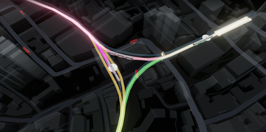
ZONE ONE offers a "Live map of central London. Every Tube, bus, train, riverboat and aircraft moving in real time".
We've seen this sort of thing before, like this real-time Tube map, or this one, or this one.
ZONE ONE, by James Potter, is way more ambitious. It brings together not just the Tube but many other forms of transport, too.
Besides the five listed above, you can also watch parts of the Overground, Thameslink, Elizabeth line, mainline trains and part of the DLR. Zoom in, and there are the vehicles, sliding around in real-time. Click on them and you'll be given their destination (and in the case of buses, even their licence plate). Traffic cameras have also been placed on the map.
It's not perfect, of course. The data feeds that power the site only have so much resolution. So, for example, it's easy to find cases of boats navigating suspiciously far inland. Trains and buses do not provide GPS data, so their locations are inferred by countdown times. Plus, the site, as per its name, only shows what's going on in Zone One.
Caveats aside, this is a spectacular visualisation of what our city's public transport is up to at any given moment. In its current form, it's too unwieldy to use as a navigation aid, but it could personalise it to show, for example, 'every bit of public transport coming near me in the next five minutes, and where it's heading', then it could have way-finding potential.
Have a play with ZONE ONE here.


