Just when you thought you'd seen every conceivable variation on the tube map, somebody comes up with yet another novel idea.
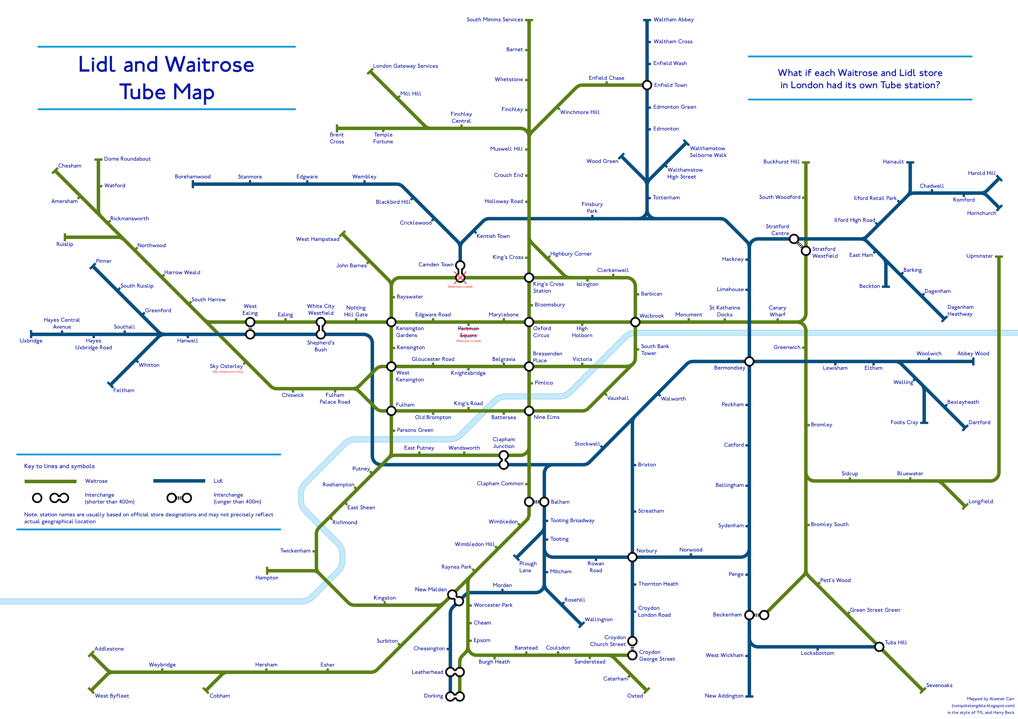
Today, it's this rather marvellous chart by Alastair Carr showing every Waitrose and every Lidl in London, as of October 2018. The two supermarket chains are connected up like metro systems, Waitrose in green, Lidl in blue.
For those not familiar with the supermarkets, Waitrose has a reputation for attracting the more affluent shopper, whereas Lidl sits at the opposite end of the scale.
As Alastair notes on the Not Quite Tangible blog, the networks are 'starkly different'. Waitrose dominates in central London, with arms feeding out particularly to wealthy west London. Lidl does not have a central London store, and tends to trade in more easterly locations.
Tellingly, only a handful of areas have both a Waitrose and a Lidl, shown on the map as interchanges. Only three London locations can boast the presence of both stores within 400 metres of one another: White City/Shepherd's Bush, Clapham Junction and New Malden.
Do take a look at Alastair's blog for more observations and information on how the map was put together. Alastair is something of an alternative map prodigy. He previously created tube maps that are inside-out, based on never-realised plans, and how the tube might look in 2040.
As is the nature of these things, this map will go out of date as stores open and close — for example, a reader points out that Hersham in the south-west now has a Lidl as well as a Waitrose.