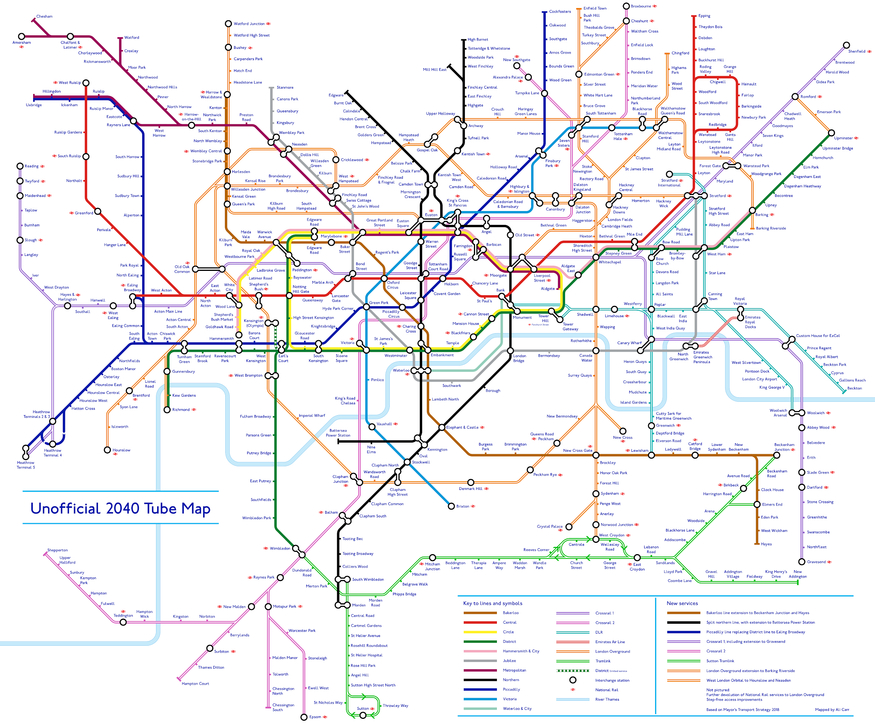
With TfL's network aggressively expanding, the tube map is going to change with it. So Redditor u/Not_Quite_Vertical has helpfully made a tube map showing what the future may look like.
It's an unofficial tube map from 2040 and is an absolute beauty.
Ways in which this tube map is different from our current one are as follows:
- The inclusion of Crossrail (top marks on not calling it the Elizabeth line)...
- ...followed by its sibling Crossrail 2 in pink.
- The Northern line is split in two and has been extended to Battersea.
- The Bakerloo line has been extended down to Lewisham and then beyond that to Beckenham Junction and Hayes.
- The GOBLIN (Gospel Oak to Barking) branch of the Overground now reaches Barking Riverside.
- Old Oak Common Station is now part of the Overground.
- The Overground network also extends to include an extra branch that travels through Cricklewood, Neasden and Harlesden, reaching down to Hounslow.
- The Trams have extended down to Sutton
It's also interesting to note what hasn't been included on the map. Most notable is the Croxley Rail Link, but it's rather unlikely that's happening anymore, so that's a good call. Also missing is the DLR Extension down to Thamesmead, which we have slightly more faith in becoming a reality.
Also missing are the many suburban rail routes that TfL would love to get its hands on, though as long as Chris Grayling is transport secretary, that's unlikely to happen.
If there's anything else on the map that we've missed please let us know down in the comments.


