
"...the sponsored Tube map is here". So regretfully announced a City AM article in December 2014, on the news that contactless card provider MBNA was paying TfL a handsome fee to have its branding stamped on the iconic London Underground map.
Eight years later, IKEA forked out £800,000 for the privilege of having its logo peppered across the map. People started wondering where this sponsorship madness would end.
Except that the sponsored Tube map was a thing from the moment Harry Beck's famous design was first published — over 80 years before the MBNA map came along.
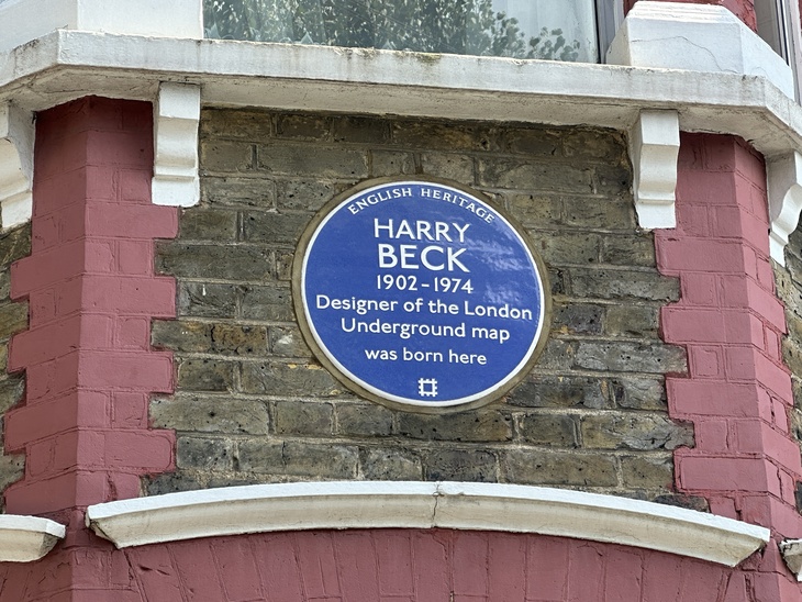
Beck will forever be remembered as the man who sold his schematic circuit board design of the previously geographical Tube map to the Underground Electric Railways Company of London (UERL; soon after to become London Transport) for the measly equivalent of £600 in today's money.
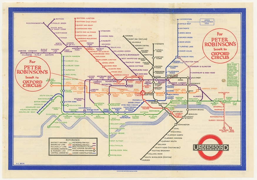
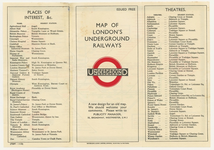
UERL was highly sceptical that Beck was onto a winner, but in January 1933, printed 750,000 copies nonetheless. Wearing its reservations on its sleeve, UERL had printed on the front of the maps: "A new design for an old map. We should welcome your comments." All 750k maps were gone within a month, a second print run was hastily arranged, and the rest is history.
Beck's instant hit was quickly a design classic, one that's revered not just by Londoners and those in the design world — but pretty much everyone everywhere — which is why people can be precious about the idea of 'soiling' it with sponsors.
However, in that original 1933 print run, some maps were indeed 'overprinted', with sponsored branding. Peter Robinson, the department store (which sometimes wrote its name 'Peter Robinson's'), was one such client, with two conspicuously circled red logos (they are, in fact, larger than the roundel itself) printed onto the map, and unsubtly directing map readers towards its Oxford Circus location. (Far more invasive than IKEA's later cameo.)
Another 1933 overprint was for prominent scrap metal merchant George Cohen, Sons and Company, whose North Acton showrooms were flagged inside a bright red rectangle on the left of the map.
Both maps were displayed by Altea gallery at the London Map Fair in June 2026.
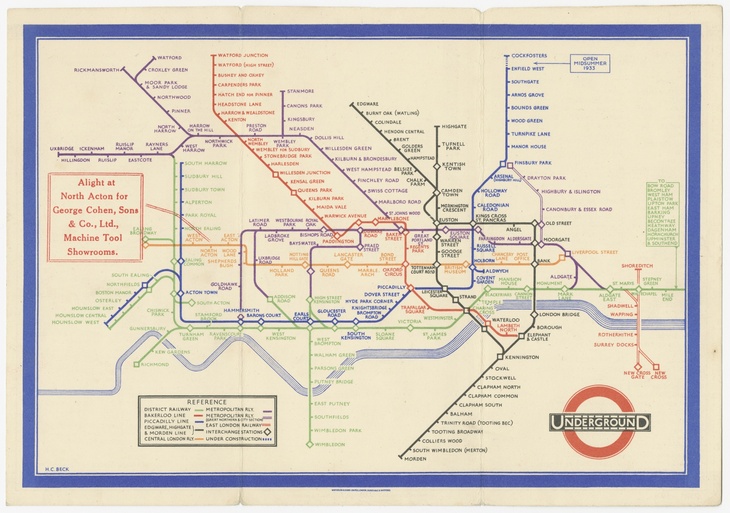
Overprinting like this, by the way, would've been carried out while the maps were first being printed — rather than added afterward by the individual companies — so it was all official and above board.
The print run for the Peter Robinson map would've been quite large, although survival rates are very low. Luca from Altea gallery tells Londonist: "These were ephemeral items, often discarded after use. Condition, combined with unusual variants such as advertising overprints, makes examples like these particularly desirable today."
Relatively few overprints would've been done in the case of the George Cohen map. Says Luca: "Variants such as this one are considered rare, as they were most likely produced in relatively small numbers, for targeted promotional use rather than general distribution."
Sponsorship on the London Underground itself has been in existence more or less from the get-go. We know, for example, that Bovril was being plugged in carriages in 1896.


