A map offering boundless ideas for cycling routes around the capital.
Have bike, will travel. But where to go? London can be a fantastic city to explore on two wheels, and now there's a map to help.
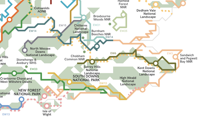
The Greenground Map Cycling Edition pulls together a web of options for navigating the city's green spaces and waterways on a bike. The bedrock of the map is a network of established routes such as TfL's Cycleways, the National Cycle Network, and the older London Cycle Network. It also suggests routes that follow rivers or canals, or which connect together green spaces along quiet streets.

Needless to say, it's quite a busy map. It's most useful as a source of inspiration for new ways to explore the capital, rather than as a navigational aid. For example, you might not have considered following the rivers Ravensbourne or Wandle on a bike before. The map shows the various place of interest along those routes, with plenty of additional 'side-missions' should you wish to deviate.
The chart, designed by Helen Ilus, comes from the same stable as the London Greenground Map, an excellent walking guide to London that we've covered before.
Both maps (and many others) can be freely viewed online, or you can buy paper versions from the same site.
In addition, Helen has also now released a fantastic map showing walking routes across the whole of the UK and Ireland. Check that one out here.