Cartographers have mapped London for many centuries and for many reasons — from assessing bomb damage, to helping tourists find the zoo. Philip Parker's book The A-Z History of London looks back on London's famous A-Z maps, and those which preceded them.

John Rocque’s beautifully engraved 24-sheet map of London took six years of meticulous surveying to compile. The new network of formal squares recently laid out to the west of the City of London, including in Mayfair and Marylebone, is clearly visible.
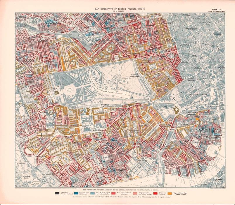
Charles Booth produced his Maps Descriptive of London Poverty as part of his more general Inquiry into Life and Labour in London (1886–1903). The distinctive colour-coding of streets (and even individual buildings) for the predominant social class made them all the more striking.

A-Z's Pictorial Map provided a colourful and accessible guide to the centre of London in the mid-1930s, with key transport links marked, as well as such useful locations as the British Museum and the Coram's Field playground.
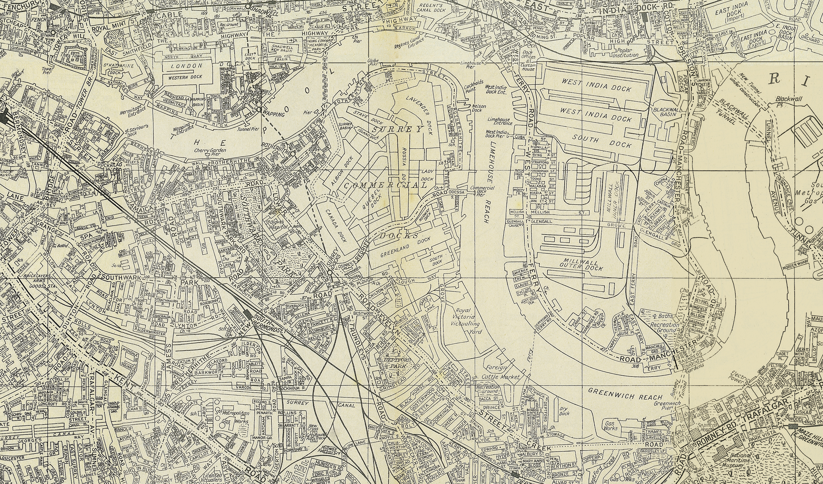
The 1938 A-Z shows a complex of active docks running the length of the riverbank from Wapping to the Isle of Dogs.

From September 1940, local authorities were tasked with assembling records of the damage caused by air raids. In the capital, surveyors from the London County Council attended after each attack and their records were used to assemble colour-coded bomb-damage maps (with black indicating total destruction and blue buildings damaged beyond repair). This map of Farringdon and the City of London shows St Paul’s Cathedral surrounded by a sea of devastation.

Bus route maps, such as this A-Z Sightseeing map of Central London, were once an essential aid for travellers in the capital. Now, with phone apps and digital timetables at bus stops, they are a relic of the past.
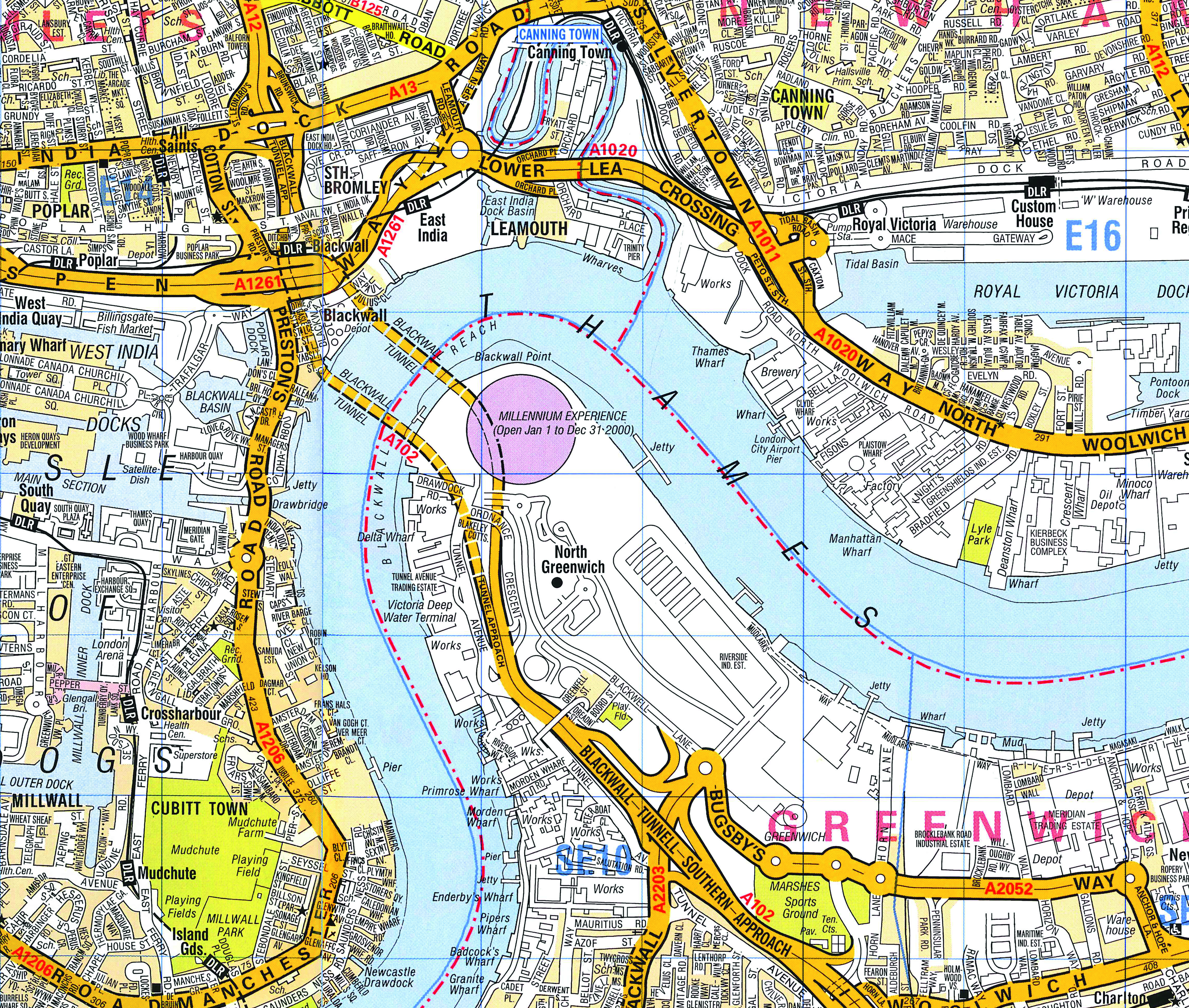
London acquired a number of new landmark buildings to celebrate the new Millennium in 2000, including the Millennium Dome, where a year-long exhibition of British culture and technology was held, and the Tate Modern, in the former Bankside Power Station, a rather more enduring tribute to British artistic prowess.
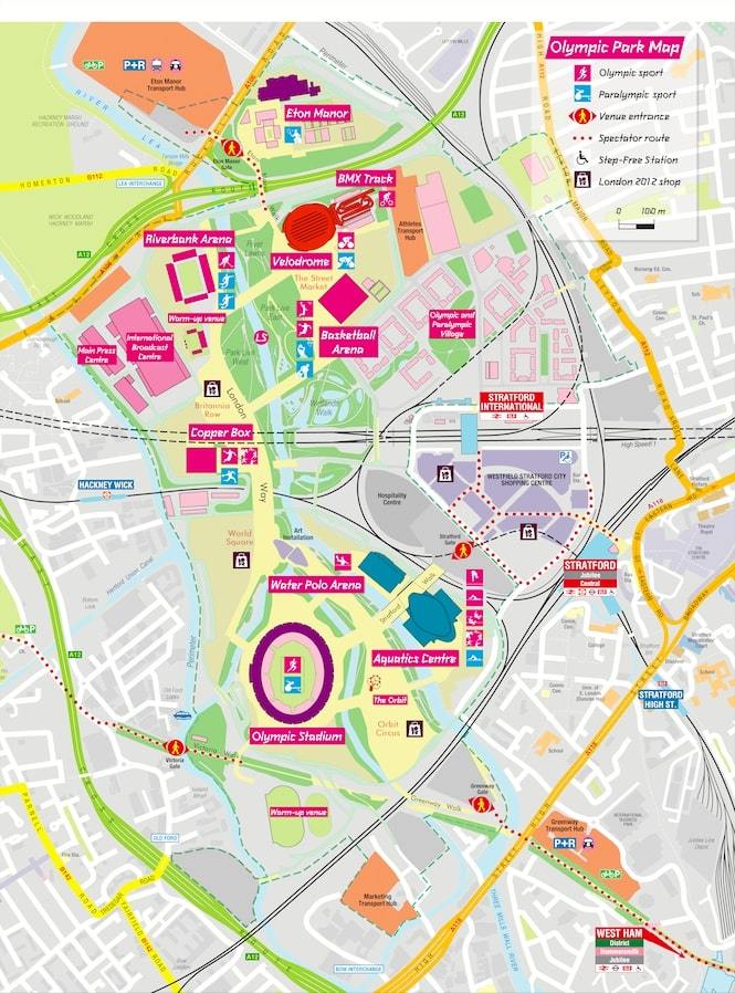
The 2012 London Olympics brought much-needed regeneration to part of east London. This map shows the extensive series of venues that were constructed in the area, much of which was redeveloped later to provide new housing.

The streetscape of the City was transformed in the early 21st century with the construction of a series of architecturally arresting buildings, including the Shard, the Cheesegrater and the Walkie-Talkie.
The A-Z History of London, by Philip Parker, is available in hardcover from 3 October 2019, for £19.99
(buying via this link will help support our site with a small commission)

All A-Z map extracts © Geographers’ A-Z Map Company Limited © Crown copyright and database rights 2019 OS 100017302


