
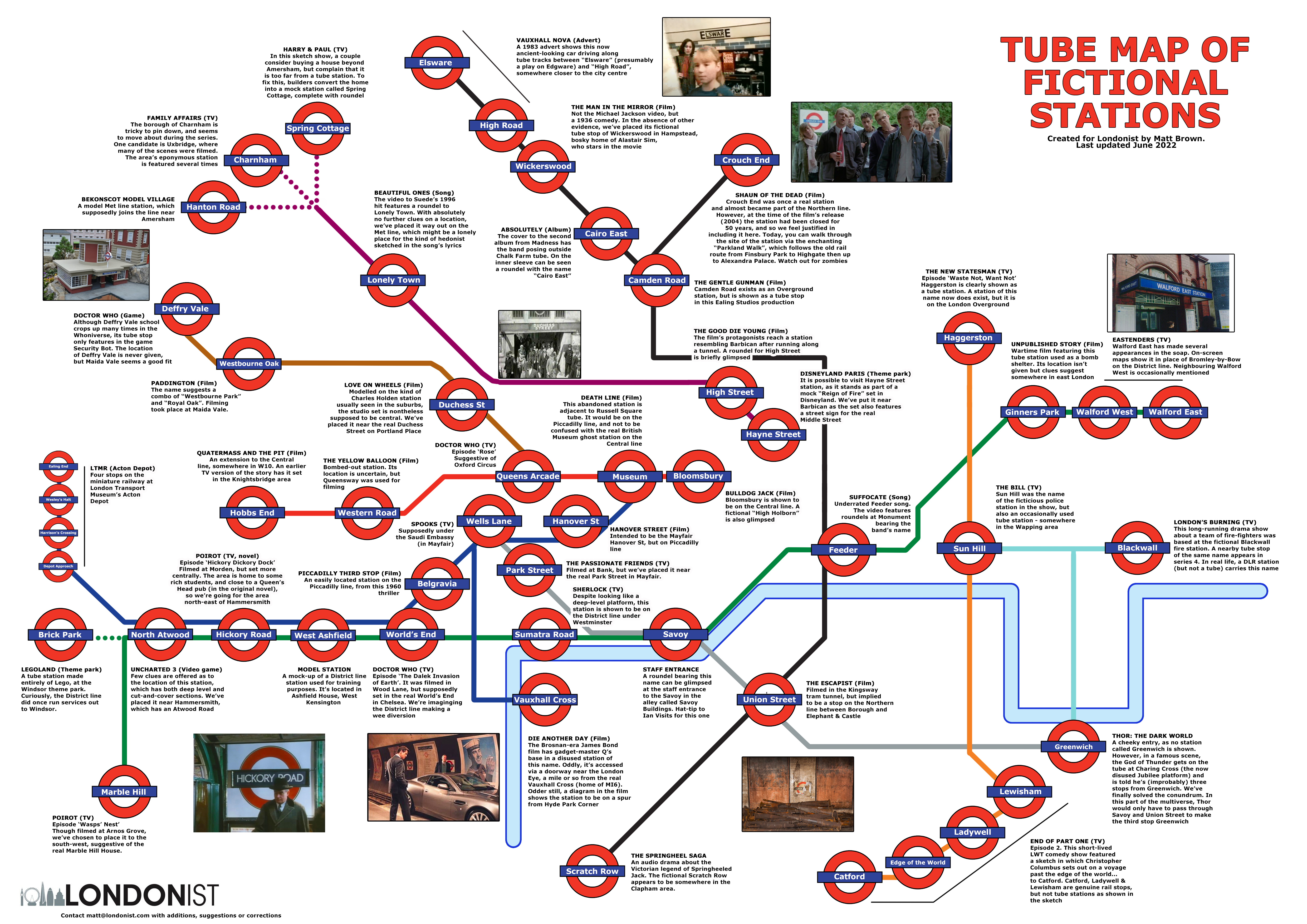
How do you get from Hobbs End to Walford East?
This tube map of fictional stations should help you navigate. We've mapped the rough locations of over 50 non-existent underground stops, drawn from films, TV, novels, video games, songs, adverts and even theme parks.
Visit the miniature stations of Brick Park (Legoland) and Hanton Road (Bekonscot Model Village). Revisit the horrors of Crouch End (Shaun of the Dead), Museum (Death Line) and Hobbs End (Quatermass and the Pit). Or reach the oddly named station of Elsware via a 1980s Vauxhall Nova.
Some are more confidently placed than others. Walford East from Eastenders, for example, is firmly established as a homologue of Bromley-by-Bow station. Others, such as Hickory Road (Poirot) and North Atwood (Uncharted 3) are speculative. Some, like Suede's Lonely Town, were never intended to be actual stations, but we've mapped them nonetheless.
In making the map, we also solved one of the great puzzles of fictional geography. How does Thor manage to get on a tube at Charing Cross and be only three stops from Greenwich? Take a look at the map to find out.
We welcome additions, corrections, suggestions and general feedback. Leave a comment below or email [email protected].
Sources
We used our own previous article on fictional stations as the main basis for the map. We should also give a shout-out to Ian Visits, whose own article includes a few additions, along with this wiki list. Personal exploration also suggested the entries at Acton Depot and Bekonscot.


