
This feature first appeared in May 2024 on Londonist: Time Machine, our much-praised history newsletter. To be the first to read new history features like this, sign up for free here.
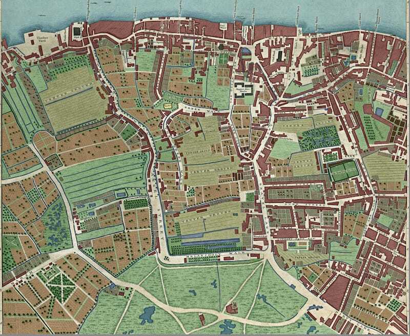
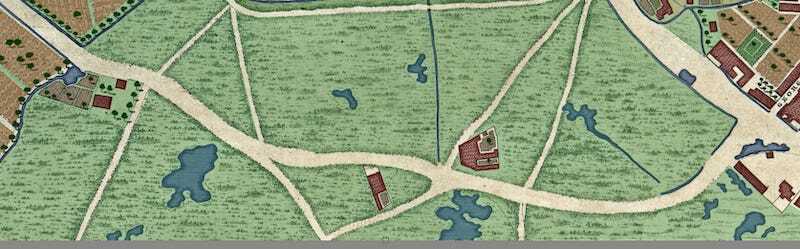
Over on Londonist: Time Machine, I've been gradually colouring in every building, field, pond, tree and road on the John Rocque map of London from 1746. (High resolution versions are available to subscribers of that Substack; see below for full links.) This helps us to visualise the different patterns of land use. At a glance, we can distinguish built-up areas from agricultural land and undeveloped land.
But I'm not just colouring in, like you would with pens or crayons. I purposely separate each feature out onto a different Photoshop layer. One layer contains buildings, another trees, another cultivated fields, and so on. This allows me to isolate one particular layer from all the rest.
So, for example, we can take Southwark/Lambeth:
And we can turn off all the layers except for water. Thus:

And then… this is the delicious part… we can superimpose these 18th century streams, pools and drainage ditches over a modern street map of the area. Huzzah!
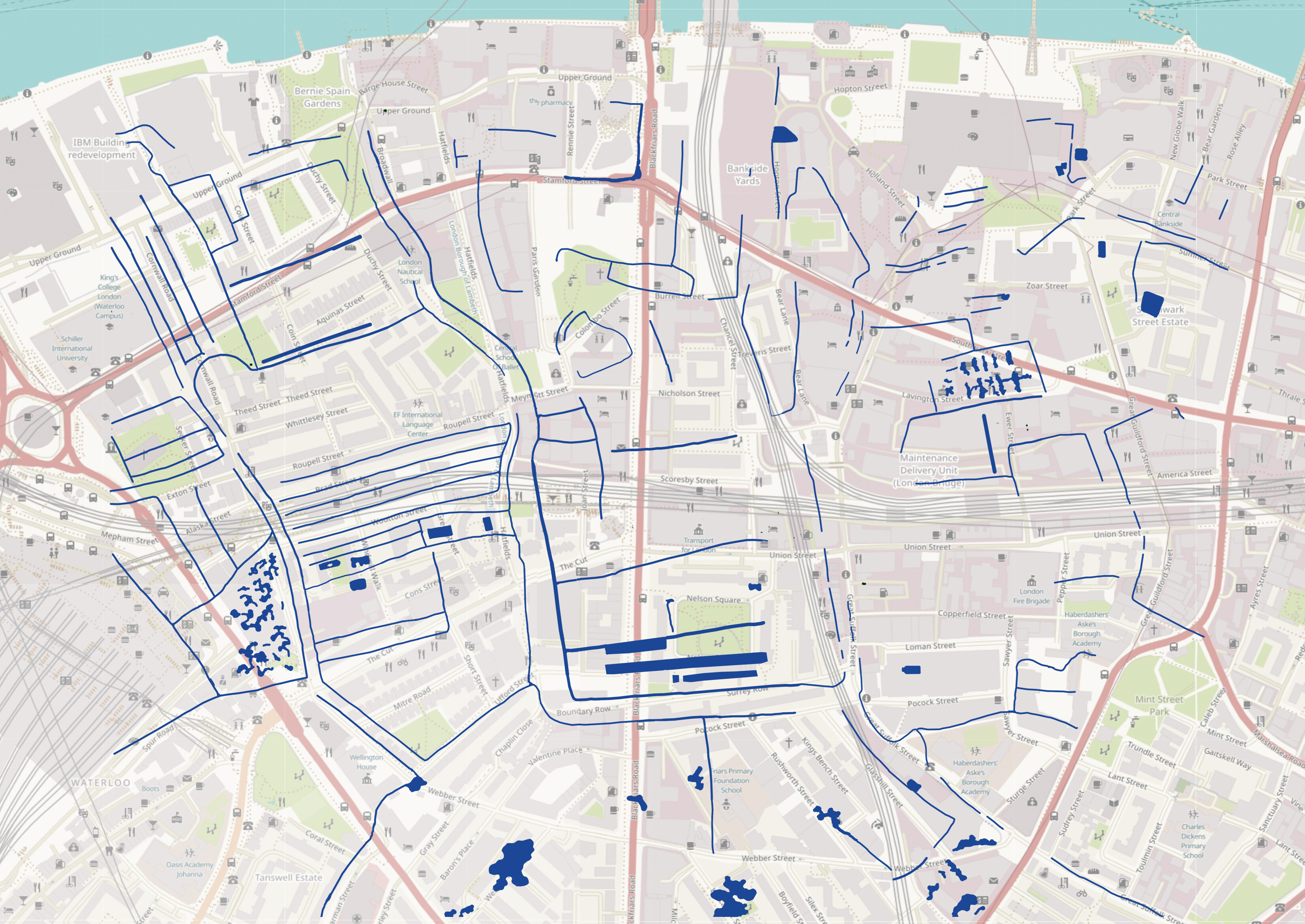
The first thing that leaps, nay, squirts out of the page is just how much water there was in south London. It’s more sodden than a Rishi Sunak press conference. This surface water is hardly noticeable on the original John Rocque map. It’s camouflaged among all the other grey-shaded detail. But colour it in, and paste it onto a modern map, and we have quite the splash. The “50 Lost Waterways of Southwark,” I’m calling them, with only a trickle of hyperbole.
Draining the swamp
In days of yore, much of Lambeth and Southwark was enswamped. This is still remembered in the street name Lower Marsh, for example. The area was largely uninhabited through medieval and Tudor times. Only two areas were reasonably developed: Bankside, famous for its theatres and brothels; and the raised land around Borough High Street that had been first settled by the Romans.
The marsh was gradually drained over the 17th and 18th centuries, to allow for the agriculture and house building we can see in the 1746 map. But the water didn’t just disappear. It was carried off in an intricate network of drainage channels, exactly as John Rocque showed. Some of these channels would have been used for irrigation, others just meandered around the place, and may have ended up as open sewers.
Now, let’s look a little closer at the hybrid map above. We can use it to speculate about how the streets of modern south London grew up in relation to the underlying pattern of fields and ditches.
**Massive caveat interlude. Rocque’s mapping was very accurate for the time, but not as rigorous as a modern survey. His map does not precisely line up with the current street plan (I used the alignment on Layers of London as a reference). This is particularly true in Lambeth, which contained few high points like church towers from which to corroborate trigonometry. I think we can assume that most of the prominent waterways and pools were real, but their precise positions may be out a little when superimposed on the modern map.**
Shaping the streets
Caveat aside, there are a few places on the hybrid map where we can speculate about historical continuations. Take the photogenic terraces of Roupell Street and its neighbours, for example. These align perfectly with a series of irrigation channels shown in the Roque map.
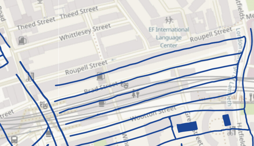
Roupell Street and its neighbours were laid out in 1824, some 80 years after the Rocque map. But they follow precisely the same trajectories as the old ditches, and are even of similar length. It’s tempting to speculate that these irrigation channels played a part in determining plot boundaries — that Roupell Street proceeds in the direction that it does thanks to the alignment of an old ditch. I find that fascinating.
We can spot other areas of interest on the hybrid map. Down at the bottom, for example, is the modern Webber Street:
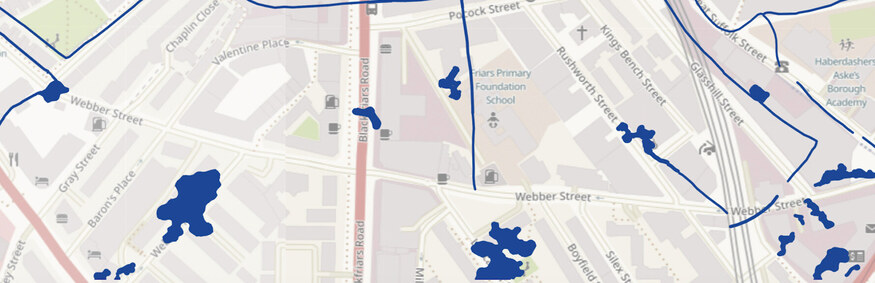
Webber Street evolved from a wide track across St George’s Fields, which can be seen in the coloured-in Rocque map.
Its path is so winding because its avoiding the marsh pools, and following the higher ground. Modern Webber Street is straighter, but it takes a similar trajectory, dictated all those years ago by swampy water.
Clearly, I’m just skimming the surface here. Much more research could be done into how land levels and old water channels influenced the streetscape of the modern city. Quite possibly somebody has written a PhD on the subject.
My only thesis here is that you *can* do proper history by colouring stuff in.
Since this article was written, I've now coloured in nine panels of the John Rocque map, having spent over 300 hours working on the project. The panels are available to subscribers as follows:
-
London Bridge, Borough and the eastern City (plus the lost waterways of Borough)
-
Wapping and part of Bermondsey (plus lost roads of the East End)
-
Bloomsbury (plus its dehydration)
-
Clerkenwell and Smithfield (plus the lost places of Clerkenwell)
-
Barbican, Moorfields and Bishopsgate (plus Who was this John Rocque fellow anyway?)
- Fitzrovia (as we now call it)


