If we ever elect a bee as Mayor of London (anything is possible these days), then this might be the result. The hexagonal plan of London was a late 19th century attempt to rationalise the largest and most confusing city on Earth.
London is subdivided into neat hexagons centred on the City of London. Each is exactly the same size, at 2 miles in diameter. Every borough has its own number (6a for Peckham, for example, or 2 for Bethnal Green). These would have been displayed on every lamp post, as an aid to navigation.
The plan was devised by John Leighton, a fellow of the Society of Antiquaries. The version presented above is from 1899, but he'd been pitching similar schemes for some time. Leighton thought that the London parliamentary borough system was a right old mess. He drew this map to illustrate the shambles.

It's a classic case of cartographic bias. By including lots of superfluous information, like borough populations, Thames bridges and even the river flow, the cluttered borough map looks awful next to his neat hexagonal scheme — which doesn't even include the Thames.
The plans met with some interest, though much of it sceptical. The Globe noted that 'The scheme is admirable on paper; and if only human beings were like the pawns on a chess-board, and would consent to be arbitrarily assigned their proper places, might even work in practice. Unfortunately they are not.'
An earlier version of the plans circulated in the press in 1870. This one's nowhere near as elegant, but does consider the zoning in higher resolution.

Needless to say, Leighton's honeycomb city never moved the authorities. One difficulty is rather obvious. Such a precise, regular scheme would cut roads and buildings in half. Were you unlucky enough to live right on a vertex, you might find that your bathroom owed council tax to Kentish Town, your living room to St Pancras, and your bedroom to Islington.
Although boundaries changed in 1899, and again in 1965, we still have a hotchpotch of irregular and differently sized boroughs. And rightly so, for we are human and not apian.
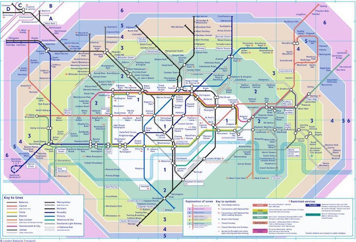
That said, one of Leighton's aims was to even out taxi fares across the city, and we do see something similar today in Transport for London's tube zones. If you look at a low-res tube map, and squint your eyes a bit, they do look a little like hexagons:
Leighton's handiwork has also inspired modern attempts to zone the city by hexagon. The plan below was proposed by the Kosmograd website in 2009.

Caroline's Miscellany has more on the career of John Leighton who, it turns out, was rather a busy bee.
Archive images from the British Newspaper Archive, copyright the Board of the British Library. The top image has been coloured by the author to match the original plans.