Adapted from a feature that first appeared in August 2025 on Londonist: Time Machine, our much-praised history newsletter. To be the first to read new history features like this, sign up for free here.
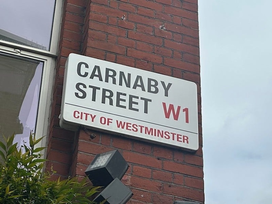
Carnaby Street, in the popular imagination, will forever look like this:
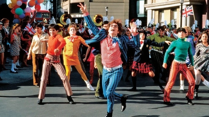
Along with King’s Road in Chelsea, the Soho street was the epicentre of the Swinging Sixties; a place that screamed “this is how to be young and trendy” not just for London, but for the world.
That story is oft-told. You’ll find it written up all over the web. I won’t say another word about it. Instead, I want to nudge our neurons towards Carnaby Street before the Swinging Sixties. After all, five-sixths of its history played out before the arrival of Quant, Jagger and Lennon.
It began with plague pits. One of the earliest maps we have of the area comes from John Strype’s Survey of London, published in 1720. Here’s how Carnaby Street is presented:
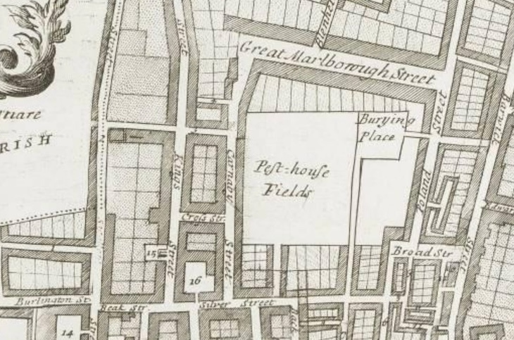
You can see Carnaby Street running north-south to the centre-left, with Kings Street (now Kingly Street) parallel to the west. But the eye is drawn more keenly to the oblong of woe marked “Pest-house Fields”, and its adjacent burying place. A pest house was a building in which the sick were isolated, in this case during the 1665 plague. The burying place was where many of them ended up. The despair and suffering on this site must have been immense.
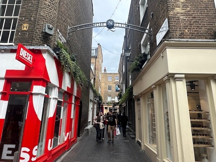
Today, this patch of land could hardly be more alive. The bars, shops and restaurants of Newburgh Street, Foubert’s Place and Lowndes Court are so densely boutiquated that they’ve spawned their own marketing catchall: ‘The Newburgh Quarter’. It has a better ring than ‘The Old-plague Quarter’.
The first buildings near the future Carnaby Street, then, were a series of pest houses for quarantining the sick. 36 of these were built during the plague year by William, Earl of Craven, whose own house was nearby on Drury Lane. Despite his name, Craven was one of the few nobles to remain in London during the worst days of 1665. He must have personally superintended the building of the pest houses on his land, and we might therefore declare him the unwitting father of Carnaby Street. He’s not really remembered in Soho today, though for a time the Carnaby area had a Craven Hall, Craven Chapel and Lord Craven’s Arms pub.
Right after the plague came the Great Fire. It didn’t get close to these parts, but the mass destruction of homes and businesses in the City stoked demand for new premises in the West End. Rapid development ensued and Soho was among the first areas to feel the march of bricks.
Carnaby Street itself sprung up around 1685, when the developer Richard Tyler built a number of dwellings and the larger ‘Karnaby House’ on the east side. It was named presumably after a Carnaby/Karnaby family, though there is a touch of onomastic mystery on that point. Tyler would also construct the parallel King Street (now Kingly Street) around the same time, as well as the adjoining cross streets. Among the first residents, so the London Encyclopaedia tells us, were a number of Huguenot immigrants, who’d recently fled Catholic France.
Strype, whose map we saw above, also gives us the first description of the street, from the same 1720 work:
"Carnaby Street is an ordinary street, which goes out of Silver-street [now Beak Street], and runs northwards almost to the Bowling-ground. On the east side of this street are the Earl of Craven's Pest Houses, seated in a large piece of ground, inclosed with a brick wall, and handsomely set with trees, in which are buildings for the entertainment of persons that shall have the plague, when it shall please God that any contagion shall happen."
Strype’s ‘survey’ had been many years in production, however, and it’s possible the pest houses were long gone by 1720.
From these beginnings, and ever after, Carnaby Street was a place of trade. 18th century references paint a picture of the diverse work going on here. We find various butchers, a dealer in Dorchester beer, a linen seller, a looking-glass and picture-frame maker, a mahogany warehouse, an upholsterer, a poulterer, a shoemaker, a ‘chymist’ (a quack pharmacist) and many others. From at least 1732, part of the area east of the street, on the former pest ground, was referred to as Carnaby Market.
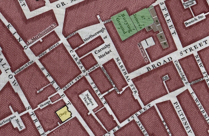
We can see this market labelled on the John Rocque map of 1746 as “Marlborough or Carnaby Market”. The market space is divided over two pockets, the last remnants of the old pest fields. Beyond the market, the burial ground of St James’s — subterraneanly teeming with plague victims — is still intact. It would be built over in the early 19th century.
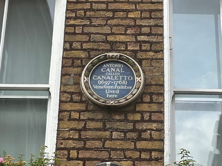
We’re looking at the streets known to Canaletto. The celebrated artist lived just around the corner from Carnaby on Silver Street (now Beak Street) from 1746, and he often displayed his paintings at home. Rocque may well have visited. Canaletto moved out nine years later, and just missed the arrival of another great artist.
William Blake (born 1757) took his first breath on Marshall Street, just metres from Carnaby Market. The natal nexus is now covered by a tower block called William Blake House. Both Blake and Canaletto appear on the left-hand side of the Spirit of Soho mural, which is easily Carnaby Street’s most interesting feature today.
Like any busy street in Georgian London, Carnaby saw its fair share of the grim and grisly. The street was the scene of a notorious murder in 1737. A Thomas Mudd got into an argument with his wife Ann, during which “she snatch’d a Knife from her Side and stabb’d him through the Back, upon which he dropp’d down dead”. Wilful murder was the verdict. Ann Mudd was later dragged through the streets on a hurdle and burned at the stake at Tyburn. The Daily Gazetteer notes that she “behaved very penitent” at the execution site. Other accounts, however, say she was “insensible” as the horrible fate unfolded. She was just 22.
Other tragedies are not hard to find on 18th century Carnaby Street. In 1739, a Mr Stalley shot himself through the head with a “fowling piece”, or shotgun. Such weapons have long barrels. The fatally ingenious Mr Stalley got round this by tying his garter to the trigger, and then pulling its other end with his foot. Bizarrely, a second man took his own life using garters the following year, this time hanging himself in the stables of a local pub, the Lord Craven’s Arms. A few years later (1747) an unnamed butcher’s boy “had the Misfortune to fall down in the Slaughter House with a large Knife in his Hand, which run into his Belly and ripped it up, so that his Bowels came out”. Needless to say, he died.
Carnaby Street seems to have seen off its residents to a particularly brutal rhythm. In 1750, a Mr Hyndes was beaten near death with hammers. In 1751, a young lad was shot in the back by a plumber. In 1753, a man dropped dead after attempting to dash to Hampstead and back in record time. In 1755, a butcher ate a hearty breakfast, and then “stabbed himself in three places”, dying immediately. It was relentless.
We could cherrypick such misadventures all day long. In truth, Carnaby Street was no more monstrous or ill-fated than any other busy street of the era. Such things were part of life in Georgian London. Besides these occasional episodes, the street remained a relatively quiet backwater.
The 19th century brought more of the same. Carnaby was still “an ordinary street”, as Strype had put it; not exactly impoverished but nor was it a place where you’d spy many top hats. Modest would perhaps be the right word. Charle’s Booth’s seminal ‘poverty map’ at the end of the century paints the street in the muted red to indicate ‘Poor and comfortable (mixed)’, with small pockets of ‘Poor’ in what’s now the Newburgh Quarter. This was essentially a street of tradesmen and shopkeepers. Oh, and pubs. At least seven could be found along the street in the 1880s.
The street’s lowest point came in 1854, when a cholera outbreak swept across Soho. It would ultimately kill around 600 locals. This was the epidemic famously mapped by Dr John Snow. His chart will be familiar to many readers — it’s reproduced in countless books on the history of London. Here it is again; I’ve coloured Carnaby Street in a putrid green.
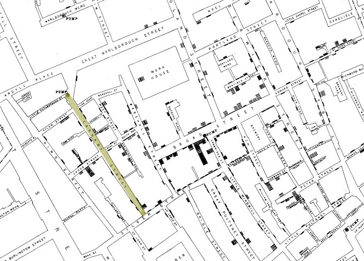
Every black mark on the map indicates one death from cholera. As you can see, the chief cluster is on Broad Street (now Broadwick Street). Dr Snow believed, correctly, that cholera was transmitted by infected water. His map pointed to the Broad Street water pump as the source of the disease, and it was later discovered to be faecally tainted. Carnaby Street, just a minute’s walk from the pump, was less affected. It had its own pump to the north. Once again, however, we find bad tidings for the ‘Newburgh Quarter’, where over 30 deaths were recorded. This was history repeating for the former pest-lands.
But now for something completely different. The end of the century saw construction of a power station on Carnaby Street. Yes, a power station, decades before Austin Powers. The St James's and Pall Mall Electric Light Company’s massive facility took up much of the south-east of the street. Built in the 1890s, it boasted a pair of 60-metre-tall chimneys which looked quite alien on the Soho streetscape. A man fell to his death down the middle of one of these in 1902.
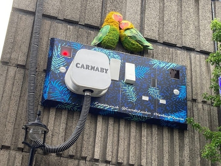
The power station closed in the 1920s, but the building lingered on unto the very eve of the Swinging Sixties. Though now long demolished, part of the site was converted into a substation, which famously sports one of London’s most arresting sculptures.
Aside from the hum of turbines, Carnaby Street still had little buzz about it as the 20th century dawned. It continued as a street of trade, with occasionally seedy corners. The area experienced mixed fortunes during the Second World War. Most of the street was undamaged by bombing, and numerous buildings still survive from the 18th century. However, the southern part around the electricity station took a clobbering.
The street’s modern reputation for music, fashion and youth culture really began in 1936, when the Florence Mills Social Parlour, named after the late singer, opened at number 50, opposite the power station. This restaurant and jazz venue was set up by Marcus Garvey, Amy Ashwood, and the calypso singer Sam Manning. It soon became a key social centre for the Black community, and a hub for discourse around Pan-Africanism. The venue then went through a number of evolutions, becoming the jazz-focussed Club Eleven, then the Sunset Club, and later the Roaring Twenties, where both the Beatles and Rolling Stones played gigs.
Meanwhile, the first boutiques were blossoming. Among them, from 1957, was John Stephen’s His Clothes. This store is often cited as the well-spring of the Carnaby revolution. It proved so influential to men’s fashion that it today carries a plaque. "He made Carnaby Street,” said Mary Quant of John Stephen. “He was Carnaby Street."
She was talking metonymically. Stephen made Carnaby Street synonymous with fashion, but he didn’t make Carnaby Street itself. As we’ve seen, this short road already had almost 300 years of history behind it. This isn’t a glamorous history, nor a momentous one. But the area’s gradual transformation from a plague-ridden backwater, from the bubonic to the iconic, from mass graves to bass grooves, is arguably more fascinating than Swinging London phenomenon itself.