
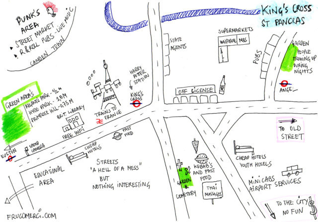
Click here for a bigger image, or press CTRL and '+' to zoom in.
This week, we're over to the erstwhile red-light district, turned emerging cultural centre of King's Cross. Reader David Sánchez has provided a balanced take on this schizophrenic area, including the good (free wifi) the bad (estate agents) and the ugly (nocturnal vomiters). Has he missed anything? (Kings Place, for starters.) Let us know in the comments what you'd have included.
And if you're feeling arty over the weekend, put together your own hand-drawn map and send it to [email protected]. We'll feature the best each Friday.
Previously: Hampstead Heath, Notting Hill.


