
Ever wondered what the oldest map of London is?
Well, the oldest surviving complete map of the city dates back to the 1570s — and it's going on display in April, as part of Magnificent Maps of London at London Metropolitan Archives.
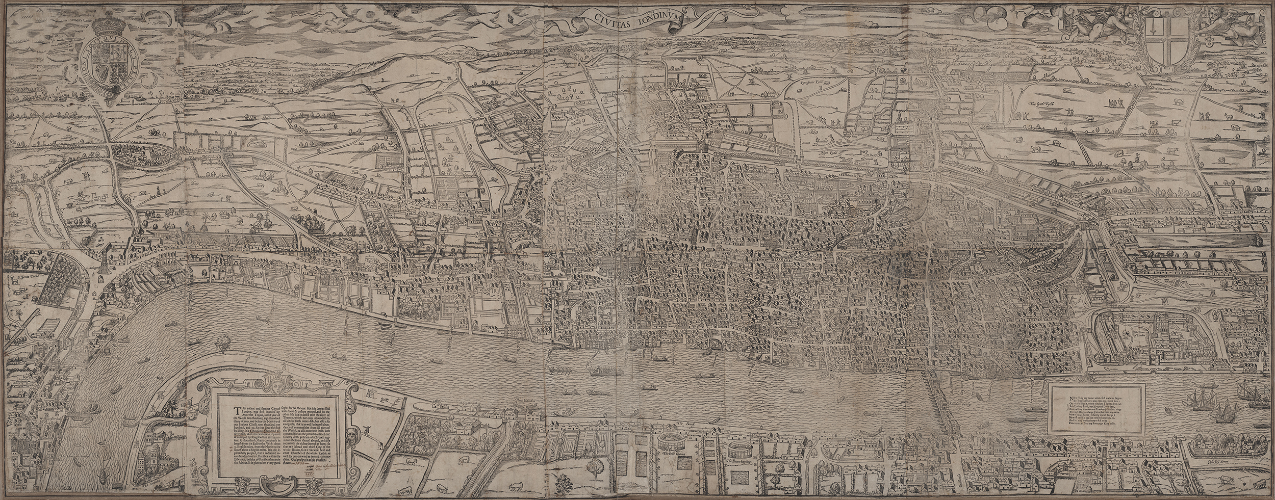
Civitas Londinium — also known as the Woodcut or Agas map — charts London across the Thames from Southwark towards the hills of Hampstead and Highgate, as it appeared in Tudor times.

The map — whose name is sometimes attributed to cartographer Ralph Agas (although he quite possibly didn't create it) — is wonderful in its detail. From bear-baiting pits in Bankside, to stupendously overfed livestock grazing fields near the Tower of London, the map might not be to scale, but it complements the lay of the land with a real flavour for the time.
Civitas Londinium is not quite the oldest surviving map of the city, however. Large fragments of the so-called 'Copperplate map' date from a few years earlier, and Civitas Londinium was based on it. However, the Copperplate is incomplete, so the Agas map wins title of 'oldest complete map'.

Other cartographical delights you can see at the free-to-visit Magnificent Maps of London include the Ruins of London survey, commissioned by the City of London Corporation following 1666's Great Fire, to help rebuild the city.
There are also 19th century maps, charting the spread of then-fatal diseases like typhoid, cholera and smallpox.
Chair of the City of London Corporation's Culture, Heritage and Libraries Committee, Wendy Hyde, said "This new exhibition gives a unique and compelling insight into how London was literally put on the map."
For a map that's both ancient and almost brand new, check out the Anglo-Saxon map of London, drafted by the hand of Londonist's own Matt Brown (and available to buy).
Magnificent Maps of London, London Metropolitan Archives, free entry. Exhibition now extended until March 2023.


