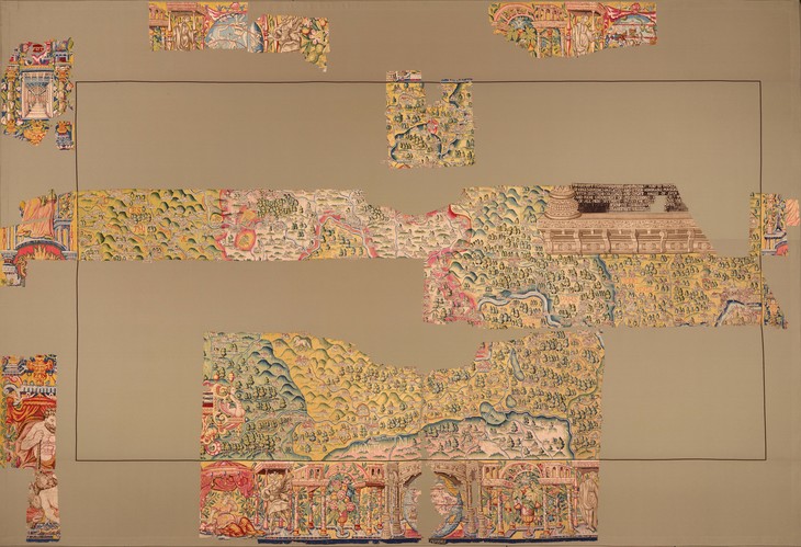
Chiswicke. Higat. Chelsey. Rislipp. Nope, our spellchecker's not on the blink; these are areas of London as they were named back when this stunning Elizabethan tapestry map was created.
The cartographic masterpiece — woven from wool and silk — depicts Oxfordshire as well as a vast area stretching from Cheltenham to central London. Landmarks of the capital depicted include the old London Bridge and St Paul's Cathedral, as well as Southwark Cathedral and Lambeth Palace.
The map hasn't been on public display for over a century, but following painstaking restoration, can now be found at Bodleian's Weston Library in Oxford.

Officially known as the Sheldon Tapestry Map of Oxfordshire, this is one of four tapestry maps commissioned by landowner Ralph Sheldon for his home in Weston, Warwickshire. Together, they were essentially one massive, woven brag, on which the Sheldon family could show off what was theirs.
Only certain fragments of the fragile work remains, and we're cock-a-hoop that London is on one of them.
See the map at Weston Library, Oxford. Admission is free.
Hungry for more? Talking Maps opens on 5 July at the Bodleian Libraries in Oxford.


