
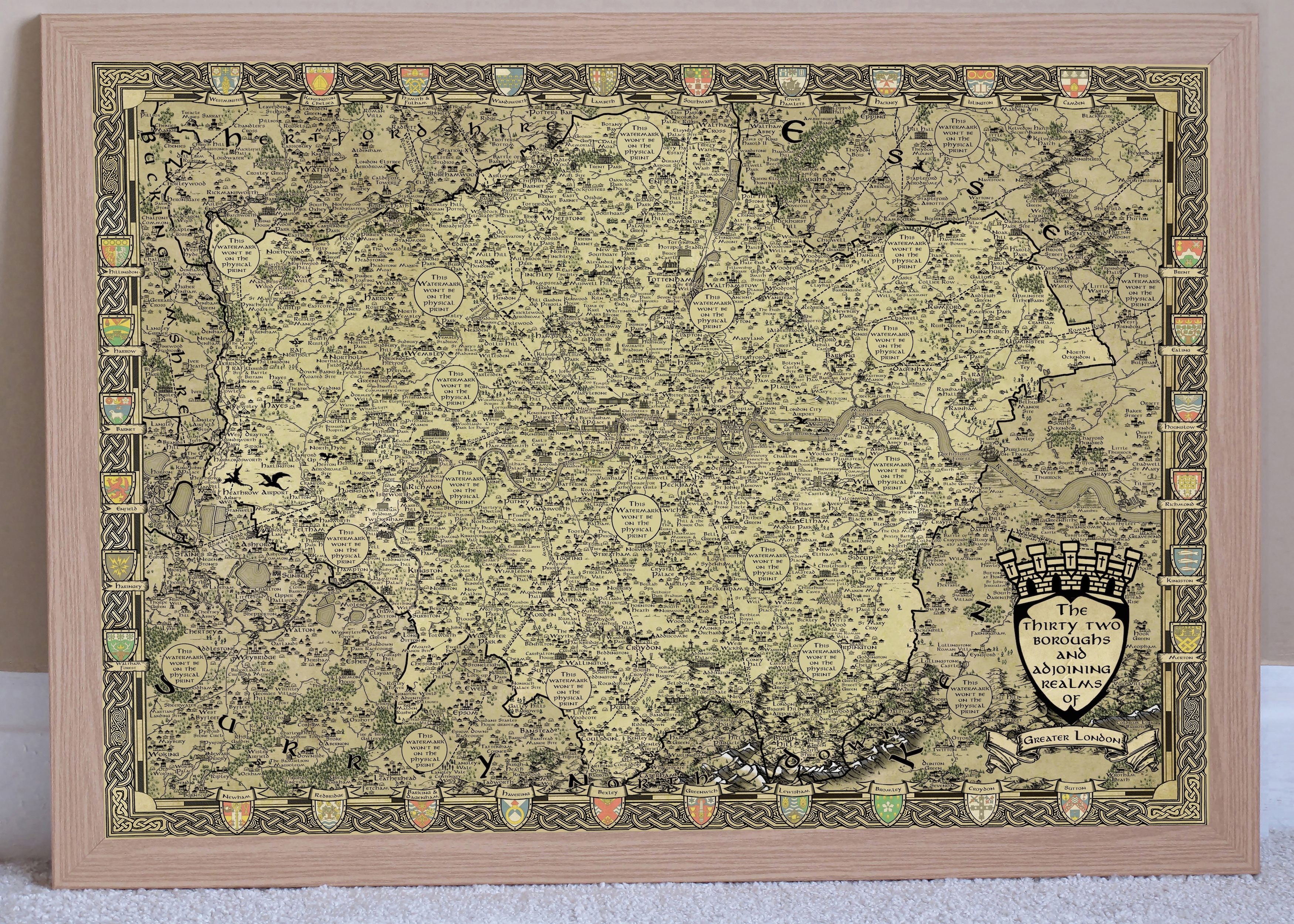
A Tolkienesque map of London conceals many hidden details.
One does not simply walk into Morden! It's impossible to avoid such puns when introducing this masterpiece by Chris Birse. Chris, a former retail manager turned fantasy cartographer, has mapped Greater London in the distinctive cartographic style used by JRR Tolkien in the Lord of the Rings novels.
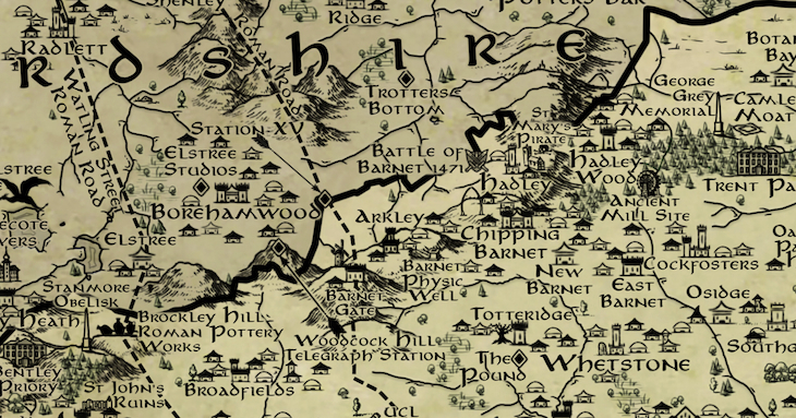
The map is packed with detail. Chris could have just plonked down all the local place names and surrounded them by trees and hills. But this is so much richer. The map weaves in ancient barrows, obelisks, wells, observatories, lost buildings, bunkers... slightly mysterious, old-timey things that Tolkien might have pencilled into his own map. Chris is not the first to draw London in a Lord-of-the-Rings style, but he's done it in the most sumptuous detail.
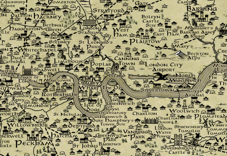
You'll also spot the "lost rivers" of London, which once flowed freely above ground but are now banished to the sewers. Ditto the Roman roads, which still underpin some of our most important routes today. City Airport, Heathrow and other airfields are represented by dragons. The devil is almost literally in the detail.
This is actually the culmination of five years of self taught fantasy cartography," Chris tells us. "Back then I was in the process of writing a fantasy novel and needed a map to go at the beginning of the book. Rather than get someone to draw it for me, I gave it a go myself and was happy with the results; so happy in fact, that I made a similar fantasy map of my home region — Teesside — for a bit of fun. I posted it online and got so much positive feedback that I realised I was onto something."
Chris has cultivated his own fellowship to help plot out the maps. He's posted on dozens of local Facebook and Reddit groups asking for suggestions, crowdsourcing the best ideas like we're still in the Internet glory days of the Noughties. "The feedback was phenomenal!, he says. "There was in excess of 3000 comments to get through over three weeks, most filled with brilliant ideas. I'm pleased to say I was able to get around 90% of those suggestions in; the remaining 10% just weren't possible at this scale. Perhaps in future I'll map the 32 boroughs individually in order to get more detail in - who knows?" To be honest, if he digs any deeper with this project, he's in danger of unleashing a Balrog.
The London map is the culmination of an epic quest to Tolkienise all the English regions. But sequels are afoot. "The next step will be doing the same for the Welsh counties, before moving onto Scotland and Northern Ireland (and maybe the US States after that)," he says.
Finally, we ask Chris how he managed to resist labelling Morden as Mordor. Because that's what we'd have done. "Morden really is almost perfect isn't it! It was tempting, but I do try and make these as accurate as possible. Besides, I had many other suggestions from locals as to where the real Mordor lies — practically every rival town/estate possible!"
If you want to get hold of a copy — and perhaps label it with your own personal Mordor — then prints can be purchased here. Other counties can be found here.


