

This map of London's East End and docklands was used by Luftwaffe bombers in the second world war. A dock and gasworks are roped off in ominous red.
Target Area II London is one of scores of fascinating maps in London: A Life In Maps by Peter Whitfield. This is the book's second incarnation. It's also been a much-lauded British Library exhibition.

The above is part of the chart of London and the Thames by Jonas Moore, c. 1662, commissioned by the Navy Office. Earlier maps of the city were more decorative than they were accurate.

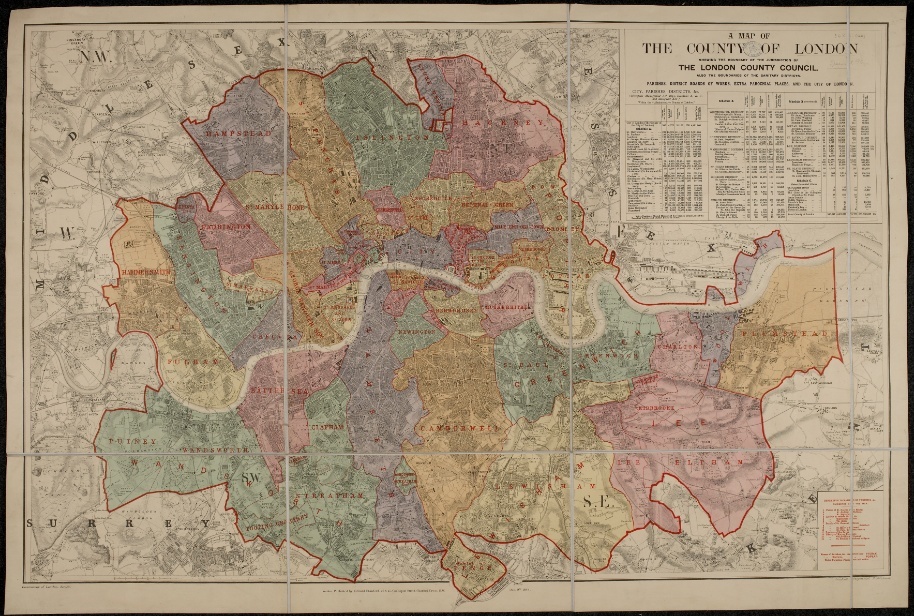
The LCC, established in 1889, was the first, historic recognition of London’s identity beyond the City and Westminster. The above colourful 1898 map shows the boundary of the LCC's jurisdiction, and the boundaries of the 'Sanitary Districts and Parishes'. Of course, this all changed in 1965, when London ballooned into 32 boroughs.

The early maps of the Underground showed the geographical layout of the lines. Then Harry Beck came along and changed everything.

The Empire Exhibition at Wembley was THE event in London in 1924. Planned to run for six months, it hung around for two years. Wembley Stadium — or the Empire Stadium as it was then — was just one part of it. The event changed this rather anonymous suburb into a sporting shrine, hosting not only cup finals but also the Olympic Games in 1948.

The heart of the City: the Mansion House, the Bank of England, the Royal Exchange, the Stock Exchange.

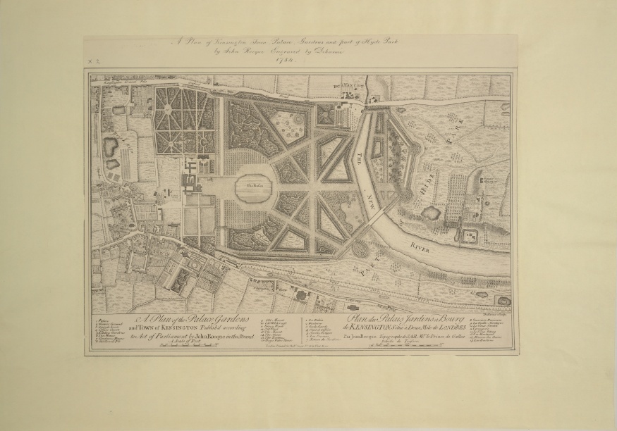
A plan of Kensington Gardens, as designed and laid out for Queen Caroline in the 1720s.
London: A Life in Maps is on sale now. All images © British Library Board.


