iOS Maps Of London: The Bad, The Bad And The Ugly

M@
By M@ Last edited 130 months ago
iOS Maps Of London: The Bad, The Bad And The Ugly

If you own an iPhone or iPad you'll be well aware of the controversy surrounding the map app. In a software update last year, Apple switched the tried-and-trusted Google Maps for its own navigation software. As people say on informal tech websites: it sucked, big time.

Dip into Apple Maps now, though, and you'll find things are looking a lot prettier. All of central London is rendered in three glorious dimensions. Train stations have popped back into existence. You can even see some of the animals in London Zoo.

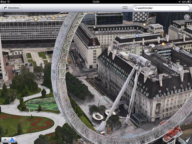
But it's easier to mock than to praise, so we've cobbled together a handful of visual howlers you can still find within Apple's maps. Do let us know in the comments if you've discovered others.

No pods, no visible means of support...the London Eye's radical new look.
A stunt road near Gloucester Road, west London.
You can have a fun old time driving across Putney Bridge.
A famous glitch has 'Big Ben' showing a different time on each clock face.
Piccadilly Circus looks like a bomb scene, with Eros smouldering, the signs all blackened and debris spread across the road.

Last Updated 11 June 2013