
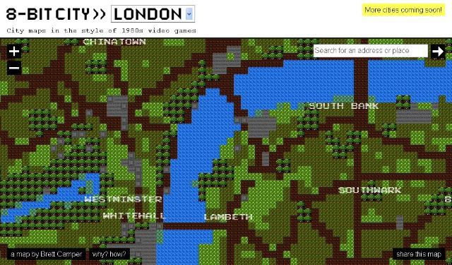
Those of a certain vintage might find this map of London comfortingly familiar. Low-res territory maps were a common element of early 8-bit computer games for the Commodore 64, ZX Spectrum and BBC Micro. Now, Brett Camper has produced a series of city maps that combine this blocky style with modern zoom and drag controls. The charts were compiled using pattern recognition on top of Open Street Map data.
According to Brett, the maps are:
An attempt to make the city feel foreign yet familiar, smashing together two culturally common models of space: the lo-fi overhead world maps of 1980s role-playing and adventure games, and the geographically accurate data that drives today's web maps and GPS navigation.
All that's missing is the urgrgrggghhhhh-eeeeeeeeee screech as the map loads. Make sure you play with the zoom - the map goes way out into the suburbs, and some of the labelled streets and businesses are rather bizarrely chosen. Londonist's house is even marked!


