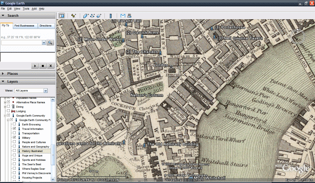
Imagine the sights and the smells of the world’s largest and most expanding city.
A city full of promise, the streets paved with the fragments of young men and women’s dreams. And other people's filth. This is Dickensian London during the serialisation of Oliver Twist, 1837-1839. See Fagin and his band of merry child thieves cheerily skipping though the streets, picking pockets and singing away as if they knew that Anti Social Behaviour Orders were way in the future and mattered to them not a jot.
Well, to aid your imaginings, the good people at Google and the Rumsey Historical Map Collection have come up with a map layer that lies on top of Google Earth that depicts Fagin’s old stamping ground of London in 1843. Clever, isn’t it?
Google Earth has regularly been impressing since it augmented the power of its application by adding optional layers of information on top of its 100% globe coverage from such geeky behemoths as National Geographic, Wikipedia, The European Space Agency and The Discovery Channel. It doesn’t end there either, loads more organisations have cottoned on to the power of the beast and the obsessed masses that worship around its fringes, and added all sorts of interactive jiggerypokery that can be switched on and off.
Who will buy this wonderful software? No need, it’s all free from Google! What would Fagin and Bill Sikes have made of that? Well, they probably would have tried to steal it anyway; it was hard times back then. But, if you like, imagine yourself picking it from the pocket of some lauded toff whilst traversing the Strand. That's what we did. It felt good.
By Simon James


