

Even at low-resolution, the John Rocque map of London (above) is a thing of beauty. But zoom in and you can see the names of individual alleyways, the empty field where your office now stands, and even the individual oars of boats upon the Thames. You can move across town with godlike abandon in this free, online version.
Rocque's map is not alone. Hundreds of old maps of London are available online — from the first maps of the 16th century to the famous Victorian poverty maps of Charles Booth. Below, we've picked out five of our favourites, all of which are freely available in high resolution.
Woodcut map of London, ~1560/1633
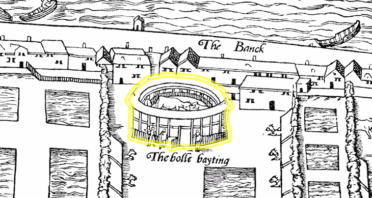
This is the earliest complete(ish) map of London in existence, probably based on the earlier-still Copperplate Map, which is mostly lost. The original version, from the 1560s, was long believed to be the work of cartographer Ralph Agas, and so sometimes goes by the name of the Agas Map. Historians now doubt the attribution. Sadly, that early version is itself lost, but a similar woodcut copy from ~1633 survives. This map has been digitised and impressively annotated by a project called The Map of Early Modern London.
Favourite detail: Our cartographer is largely untroubled by the rules of perspective drawing and proportion. Hence, the map is peppered with oddities, like the house-sized cattle in the 'bolle bayting' ring, shown above on Bankside. Also, those squiggle-filled rectangles: they're pike farms, apparently.
John Rocque Map, 1746
John Rocque gave us the first detailed map of London. His 1746 map includes every named court and alleyway. It shows a much smaller city, with areas like Bloomsbury, Marylebone and most of Southwark largely undeveloped.
Favourite detail: a pair of intriguing neighbours in Shoreditch: 'Mr Witanoom's Vinegar Yard' and the 'Holy-Well Mount' (recently excavated, next to the Pizza Express).
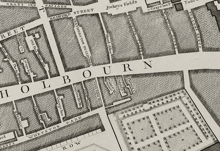
Richard Horwood's Map, 1792-99

Matthew Sangster has taken a digital version of this important Georgian map, and overlaid it with clickable pins, including notes from a 1789 guidebook to London, or aquatints from the period.
Favourite detail: The area that would one day be Victoria is mostly underwater, in a series of basins and side-arms of the Grosvenor canal (see pic).
Charles Booth Poverty Maps, 1886-1903

The Charles Booth Online Archive preserves the notebooks and maps of the great social surveyor, who toured the streets of Victorian and Edwardian London mapping levels of wealth — from the poshest (yellow) to the lowliest (black and blue). LSE's website has an almost unusable map interface, but the mobile version is much better, with intuitive zoom and the ability to superimpose on a modern map.
Ordnance Survey map, 1897
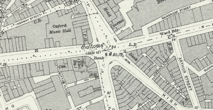
A supremely detailed map that shows London right down to its individual buildings, tram lines, underground railways, statues and public toilets. It even reveals where you'll find a dovecot in Buckingham Palace Gardens. The interface, from the National Library of Scotland, allows you to superimpose this remarkable old map over a modern map of the same scale, allowing direct comparison. This is an indispensable resource for anyone interested in the late Victorian period. Much of England and Scotland is covered in a similar way.
Favourite detail: The map goes out of its way to pack in information. It even includes long-lost landmarks such as the gallows at the foot of Tottenham Court Road (see pic).
Other maps
The five maps above are just a start — these are the resources we've found most useful over many years of researching London's history. You'll find plenty of other gems over on the Mapco site, as well as Old Maps Online. Those who want to use old maps to explore modern London might try one of the Old Map Tours from London Trails.


