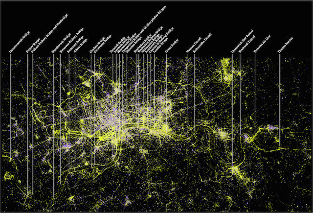

Looking like satellite images of the capital at night, the graphics above actually show the places that people take photographs in London. Alex Kachkaev and Jo Wood, of the giCentre at City University London, created the visualisation using over 1 million geolocated photographs on Flickr.
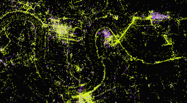
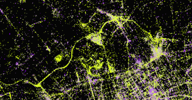
Shots in daylight are shown as yellow dots, while purple dots show photographs taken at night or indoors (i.e. lower light). Great clusters can be seen along the Thames and its bridges, but other waterways are also prominent. Note how the Regent's Canal and the Serpentine stand out more strongly than most of the city's roads. Over in North Greenwich, a patch of purple indicates the large number of shots taken at gigs at the O2. Nearby, the Thames cable car takes on an unaccustomed prominence, shown as a bright streak of daytime photography.
A high-resolution version of the image will greet visitors to the Bridge exhibition at Museum of London Docklands, which opens on 27 June. Londonist is proud to be Media Partner for this exhibition, which explores the bridges of the Thames through photographs, paintings and other works.