Apollo Moon Maps Superimposed On London

M@
By M@ Last edited 177 months ago

Last Updated 17 July 2009

Apollo Moon Maps Superimposed On London
The Apollo 12 crew were much more adventurous, ranging as far as Carlton House Terrace. (A pleasant treat for the Royal Society.)
The area explored by the Apollo 11 astronauts was tiny. Buzz and Neil wouldn't have even made it onto the fourth plinth.
Later missions had use of the Lunar Rover and travelled much further. Apollo 18 (shown in Hammersmith & City pink) would have ventured all the way to the Wetland Centre at Barnes.

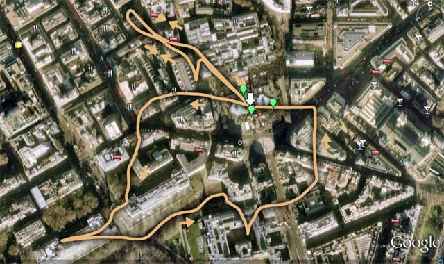
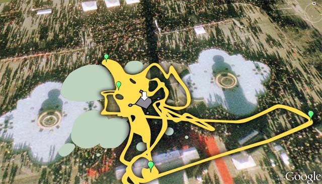
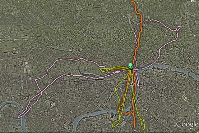
As the 40th anniversary of the first moon landing approaches, news outlets everywhere are wondering how they can bargepole in a local angle. We thought the Standard were doing well earlier, when they interviewed a Londoner who worked on Apollo's radar systems. And here's the Times talking about Apollo gadgets in the Science Museum. But those efforts are blown to space dust by the New Scientist, who ask 'What if the Eagle had Landed in London'?

They've built a Google Earth file that shows the exploratory routes taken by the crews of the six missions to land on the moon. We dipped into the experience and, for the lazy who can't be bothered to boot up Google Earth, present three screengrabs. You can download the kmz file here, or check out New Scientist's interpretations here. They've also superimposed the files on New York, Los Angeles, Boston and Sydney.